
Tropical Storm Bertha heads for final Gulf landfall as it fuels bigger flooding rain threat in the East
Bertha Storm Brings Gulf Landfall and Eastern Flood Risk
Final Landfall Approaches for Tropical System
Healfromzero.com – The tropical system known as Bertha is preparing to make its last landfall along the northwest Gulf Coast on Thursday. This weather event will deliver tropical storm-force wind gusts and steady rainfall to portions of the Texas and Louisiana shorelines. However, the most extensive flooding danger is developing hundreds of miles to the east. This somewhat disorganized, asymmetrical tropical system was positioned just south of the southwest Louisiana coastline during late Thursday morning, maintaining maximum sustained winds of 45 miles per hour. Meteorologists anticipate Bertha will arrive at the upper Texas coastline by late Thursday afternoon or early evening, subsequently tracking farther inland across Texas throughout Thursday night.
The storm’s uneven structure, characterized by most of its storminess concentrated over the Gulf waters, means tropical storm-force wind gusts will primarily affect the upper Texas Coast and southwest Louisiana. A larger portion of its rainfall will be directed toward South Texas. A tropical storm warning covering sustained winds of 39 miles per hour or greater remains active from the upper Texas Coast, including Galveston, extending to south-central Louisiana, where tropical storm conditions are anticipated Thursday. Further south, the system could deliver between 2 and 4 inches of precipitation, with isolated totals reaching 6 inches, to select areas along the middle Texas Gulf Coast and South Texas through Thursday night.
Eastern Flooding Threat Expands Through Friday
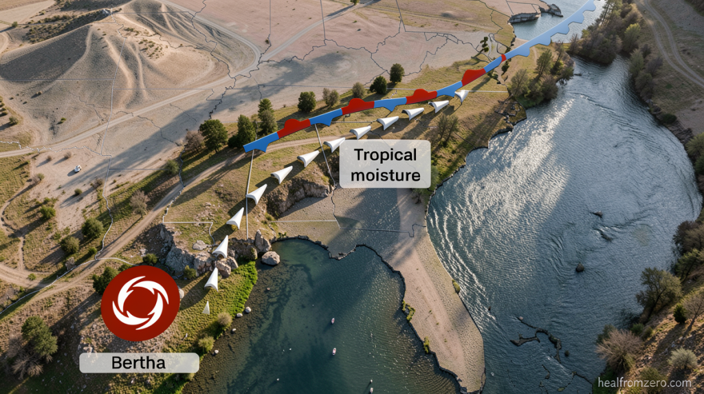
Meanwhile, a substantial plume of tropical moisture connected to Bertha is supplying soaking rain along a cold front positioned across the Southeast region. This moisture will continue to intensify a flooding rainfall threat through Friday, stretching from North and South Carolina to northern portions of Georgia and Alabama. The potential flooding impacts in this eastern corridor could actually exceed those occurring near the landfall location. Some regions within North Carolina have already accumulated an entire month’s worth of precipitation within just several days, with additional rainfall expected.
Heavy precipitation during Thursday morning triggered flash flood warnings across southeast Virginia, eastern North Carolina, and eastern Tennessee. Flooding temporarily closed a brief segment of Interstate 40 northwest of Durham, North Carolina, on Thursday morning before the highway reopened, according to the state’s department of transportation. Flash flood warnings were also activated in north-central North Carolina, encompassing Greensboro and Winston-Salem, during Wednesday night. In those locations, heavy storms deposited up to 6 inches of rain within a 12-hour period.
Despite the substantial rainfall, no flood reports emerged from the area, where an ongoing serious drought and prolonged rather than intense rainfall patterns have helped lessen the flooding threat thus far. Bertha represents the second named storm of the Atlantic hurricane season, which has experienced a comparatively slow beginning relative to recent years as El Niño strengthens its influence across parts of the basin. Bertha’s moisture started funneling into a slow-moving front draped across the Southeast and southern Virginia in earnest on Wednesday, establishing the foundation for the current flood threat.
On Wednesday morning, storms generated flash flooding north of Knoxville, Tennessee, following the fall of up to 5 inches of rain within a few hours. Additional rounds of precipitation are anticipated through Friday. While the Carolinas require rainfall to alleviate drought conditions, repeated heavy rain over the same areas within hours or days could rapidly trigger dangerous flash flooding. Thursday afternoon thunderstorms may deliver rainfall rates approaching 2 inches per hour—an intensity capable of quickly overwhelming drainage systems and flooding urban areas. Atlanta, Birmingham in Alabama, and Charlotte in North Carolina rank among the cities facing elevated risk.
The flood threat will persist through Friday, with a Level 2 of 4 risk of flooding rain extending from coastal North Carolina through South Carolina, northern Georgia, and into northeast Alabama.
Turn around, don’t drown. 🌀 ⛈️ Get your storm forecast in the CNN Weather app
Tropical Storm Bertha will bring locally heavy rainfall and a risk for isolated flash flooding today across Texas. The current rainfall forecast calls for 2-4 inches of rain with locally higher amounts possible.